🌍 Create Professional Maps with Surfer®
Communicate spatial data clearly and effectively – whether simple or complex. Surfer® empowers you to create high-quality maps and 3D models to present your insights to colleagues, clients, and decision-makers.
🗺️ Surfer Map Types – Powerful & Versatile Visualization Options
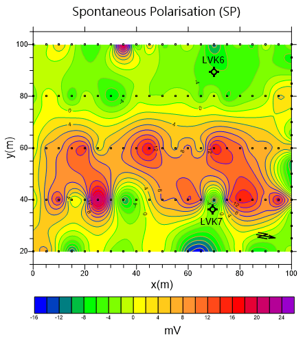
✔ Contour Maps
✔ Base Maps
✔ Post Maps
✔ 3D Surface Maps
✔ Color Relief Maps
✔ Classified Post Maps
✔ 3D Wireframe Models
✔ Vector Maps (1-Grid & 2-Grid)
✔ Shaded Relief Maps
✔ Watershed Maps
✔ Grid Value Maps
✔ Viewshed Analysis Maps
✔ LiDAR Point Cloud Maps
📌 Multi-Dimensional Data Modeling – Gain Deeper Insights in 3D
The built-in 3D Viewer allows you to seamlessly switch between 2D and 3D views, helping you uncover patterns, trends, and anomalies more intuitively.
🔄 360° Interaction & Exploration:
✔ Rotate and tilt maps
✔ Walk through and explore surfaces
✔ Adjust vertical exaggeration
✔ Create and share fly-through videos
💡 LiDAR Point Clouds – Maximum Precision for Professional Applications
Use high-resolution LiDAR technology for in-depth analysis in GIS, archaeology, surveying, and more.
Surfer LiDAR Tools Include:
✅ Combine LAS/LAZ files into point clouds
✅ Visualize points by elevation, intensity, or classification
✅ Filter, select & classify points interactively
✅ Export modified point cloud data
✅ Full 3D point cloud visualization
📍 LAS/LAZ Import Filters:
✔ Filter by XY or Z range
✔ Import every nth point
✔ Filter by return type & classification
✔ Import by source ID
🖥️ Intuitive Interface & Streamlined Workflows
🚀 Be productive in minutes – Surfer is designed for ease of use without sacrificing power.
✔ Welcome dialog for fast project setup
✔ Map wizard for guided map creation
✔ Customizable ribbon and quick-access menus
✔ Floating or docked panes
✔ Unified map and data view
🎨 Customize Maps & 3D Models to Match Your Needs
Create visually compelling graphics for reports, publications, or presentations.
Customization Options Include:
✅ Add legends, scale bars, headers & footers
✅ Define linear/logarithmic color scales
✅ Adjust rotation, tilt & perspective
✅ Modify gridlines and axis intervals
✅ Style lines, fills & symbols
✅ Overlay multiple maps and datasets
🧮 Full Control Over Gridded Data & Interpolation
Surfer offers a wide range of gridding and data editing features:
✔ Edit grids directly
✔ Perform volume and area calculations
✔ Combine or subtract grids
✔ Conduct Fourier and spectral analysis
✔ Mosaic and reproject grid datasets
📏 Advanced Interpolation Methods:
✔ Kriging
✔ Inverse Distance Weighting (IDW)
✔ Minimum Curvature
✔ Triangulation
✔ Natural Neighbor
✔ More…
📌 Interpolation Tools:
✔ Custom variogram modeling
✔ Outlier detection & error analysis
✔ Breakline & search radius support
✔ Automatic grid statistics generation
🛠️ Geoprocessing Tools – Make Smarter Decisions with Spatial Data
✔ Delaunay triangulation
✔ Polygon and line conversions
✔ Object editing and transformations
✔ Image georeferencing
✔ Buffer zone creation
📍 Advanced Symbolization & Data Representation
✔ Symbol and color assignment based on attribute values
✔ Classified or unclassified color schemes
✔ Fully customizable legends and labels
🌐 Direct Access to Online Mapping Services
Incorporate real-time geospatial data from global servers:
✔ WMS (Web Map Service)
✔ OSM (OpenStreetMap)
✔ WCS (Web Coverage Service)
✔ WFS (Web Feature Service)
📐 Coordinate System Management – Accurate Spatial Transformations
✔ Over 2,500 predefined coordinate systems
✔ Create and save custom CRS
✔ Reproject datasets easily
✔ Add graticules and grid lines for precise cartography
🔄 Maximum Compatibility & Seamless Data Sharing
✔ Import formats: SHP, DXF, XLSX, CSV & more
✔ Export maps as PDF, TIFF, PNG, JPG
✔ Web-ready map sharing
✔ Direct integration with Microsoft Word & PowerPoint
📤 Share your maps & models with just one click!
💬 Conclusion: Surfer – 3D Mapping, Analysis & Modeling Made Easy
Whether you're working in geology, hydrology, environmental science, or engineering, Surfer gives you everything you need to build, analyze, and share compelling maps and spatial models.
📥 Download a free trial now and explore the full power of Surfer:
➡ Official Surfer Website


